
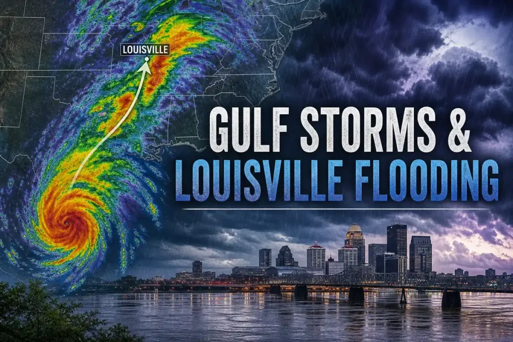
Gulf Tropical Remnants Reaching the Ohio Valley: Louisville Water Damage Risk in September and October 2026 is not a coastal-weather story. It is a property-loss story, and for Louisville owners the business stake is direct: faster water intrusion, larger mold scope, longer downtime, and harder insurance disputes when late-season Gulf moisture runs into saturated ground and constrained drainage. Based on analysis of inland flood patterns, restoration loss files, and Ohio Valley basin behavior, the recommendation is simple: treat every September and October remnant event as a serious water-damage threat until local rainfall, streamflow, and site conditions prove otherwise.
Why Gulf Storm Remnants Matter in Louisville’s September and October Damage Season
Late-season Gulf remnants drive a very specific loss pattern in Louisville. Water enters first, then hidden saturation spreads, then costs rise. By the time a roof leak shows through plaster, a basement drain surcharges, or a rear commercial suite takes on contaminated water, the repair outcome already depends on what happened before the storm and what gets done in the first day after it.
That is why this topic belongs in the same conversation as occupancy, rent preservation, reopen speed, and claim recovery. A one-day rain event can turn into weeks of dehumidification, demolition, tenant complaints, missed revenue, and disputes about pre-existing conditions versus sudden storm damage. For historic homes, the margin is smaller. For tenant-occupied property, reporting delays make the spread worse. For small commercial sites, every extra closure day has a measurable cost.
What the field data shows is consistent. Louisville losses spike when four conditions line up at once: deep tropical moisture, long rain duration, saturated basin conditions, and local drainage limits. Once those drivers align, the storm name matters less than the water path into the structure.
What Gulf Tropical Remnants Are and Why They Reach the Ohio Valley
Gulf tropical remnants are the inland remains of tropical storms or hurricanes after landfall, still carrying a large moisture load even after headline wind weakens. In plain English, the storm loses coastal identity before it loses the rain.
That distinction matters because Louisville sits far enough inland that many owners mentally file tropical systems as somebody else’s problem. That is the wrong model. Moisture from the Gulf regularly travels north into the Ohio Valley, and once that moisture interacts with fronts, terrain, and existing basin conditions, heavy inland rain becomes the real hazard. The National Hurricane Center tracks the storm core, but inland flood risk often depends just as much on rain shields, feeder bands, and the speed of the overall system.
How a Gulf System Changes After Landfall
After landfall, a tropical system often weakens in wind intensity because it loses the warm ocean energy source. But the atmosphere does not instantly unload all that water. The remnant circulation, or even a broad tropical moisture plume, continues moving inland and feeding intense rainfall. That is why the inland damage pattern rarely tracks neatly with the coastal category label.
For Louisville property owners, that means a downgraded system still produces major losses. Roofs fail under hours of steady rain. Foundation walls face hydrostatic pressure after the soil profile fills. Storm drains surcharge. Low commercial doorways take in runoff. None of those outcomes require hurricane-force wind over Jefferson County.
Why September and October Are High-Risk Months
September and October sit in a dangerous overlap zone. Gulf waters remain warm enough to support active tropical systems, but inland fall patterns slow storm motion and increase the chance of prolonged rain. At the same time, Louisville often enters this period with repeated late-summer rainfall already in the ground. Add leaf-clogged drains, neglected gutters, and reduced daylight for rapid response, and the loss exposure rises sharply.
The operational issue is cumulative stress. One rain event primes the soil. Another fills ditches and detention areas. A tropical remnant then arrives with unusually high atmospheric moisture, and the local system runs out of capacity. Based on flood-outlook methods used by the Ohio River Forecast Center and streamflow monitoring from the USGS, antecedent conditions often decide whether a property sees manageable runoff or a claim-grade water intrusion.
The Four Drivers That Turn Gulf Remnants Into Louisville Flood Risk
Louisville flood losses from Gulf remnants follow four drivers with unusual consistency. The first is moisture load. The second is duration. The third is pre-storm basin saturation. The fourth is the built environment itself. If you understand those four drivers, you can usually explain why one neighborhood floods while another escapes, and why one basement dries out quickly while another turns into a sewage and mold project.
Driver 1: Deep Tropical Moisture Reaches the Ohio Valley
Tropical remnants transport far more water vapor than ordinary inland systems. That means rainfall totals run higher, downpours intensify faster, and hourly rates climb into the range that overwhelms urban drainage. The atmosphere simply has more water available to release.
For Louisville, that added moisture matters because stormwater systems, roof assemblies, and sump setups are built around ordinary stress, not tropical load. A property that handles a typical summer thunderstorm can still fail under tropical-duration rain. Streets pond earlier. Downspouts back up. Window wells fill. Even sound roofs start showing leaks when water stands, backs up, or repeatedly finds a weak flashing joint.
Driver 2: Slow Storm Motion Extends Rainfall Duration
Peak intensity gets attention, but duration is what turns nuisance water into structural damage. When rain bands train over the same corridor or a remnant slows against a frontal boundary, your property loses the ability to recover between bursts. Soil stops absorbing. Sumps run continuously. Flat roofs stay loaded. Foundation walls stay wet.
That is where many owners misread the risk. A storm does not need a dramatic one-hour cloudburst to produce a large claim. Twelve to twenty-four hours of repeated moderate to heavy rain often does more damage because it exploits every weak point long enough to break through. For older basements and low commercial spaces, prolonged pressure is the real enemy. If your site has a history of seepage after days of rain, review how multi-day saturation affects older foundation systems because the loss mechanism is usually pressure and persistence, not a single violent burst.
Driver 3: Saturated Soil and River Basin Conditions Remove the Margin of Safety
The same storm causes completely different outcomes depending on what the ground, creeks, and rivers were doing before arrival. Dry ground absorbs. Saturated ground sheds. High streams respond faster. Elevated river stages reduce drainage efficiency and increase backwater pressure.
This is not abstract hydrology. It is the difference between water staying in the yard and water entering the basement stairwell. Flood outlook products consistently evaluate recent precipitation, soil moisture, streamflow, and river forecasts because those variables define the remaining storage capacity in the basin. The National Water Prediction Service and OHRFC forecast pages are useful because they show baseline stress, not just incoming rain.
Driver 4: Louisville’s Built Environment Amplifies Water Damage
Louisville’s built environment turns weather into property damage faster than many owners realize. Combined sewers in older areas, basement-heavy housing stock, dense pavement, aging drains, hillside runoff, and low-lying road segments all shorten the time between rainfall and interior water entry. Historic structures add another layer: masonry walls, old drain tile, legacy repairs, and hidden deterioration behind finished surfaces.
Urban drainage also fails unevenly. One block sees curb ponding because inlets are clogged. Another backs up because private laterals are compromised. A shopping strip floods at rear service doors because lot drainage pitches the wrong way. The weather event is regional, but the damage path is hyperlocal.
Why Louisville Takes Damage Even When the Storm Center Stays Far Away
A direct track over Kentucky is not required for serious local losses. In fact, some of the most disruptive inland flood events happen when the center stays well away from Louisville but the rain shield expands across the Ohio Valley. Distance from the eye is not protection against rainfall.
Rainfall Footprint vs. Wind Footprint
Tropical remnants often carry a broader rain footprint inland than a damaging wind footprint. That is why local messaging may emphasize flood watches, excessive rainfall outlooks, and river forecasts instead of hurricane language. The label sounds less dramatic, but the property threat is often greater because owners drop their guard when wind headlines are absent.
This is one reason inland losses surprise people. A storm category describes wind near the coast, not what your basement floor drain is about to do. Once the system moves north, the dominant hazard becomes water distribution across a wide area. Broad, repeated rain over the basin does the work.
Ohio River, Beargrass Creek, Ponding Streets, and Basement Flooding
Louisville’s flood pathways are familiar once you look for them. Beargrass Creek and similar channels react quickly to intense rain. Ponded streets push water toward driveways and stairwells. Storm sewers surcharge and force water backward into low drains. Elevated Ohio River conditions slow local outflow and increase backwater effects in connected systems. If you need the distinction, this explanation of backwater flooding versus flash flooding around Louisville basements helps separate two losses that look similar at the floor but originate very differently.
For your property, the key is not just whether water is nearby. The key is where the system loses capacity first. In many Louisville losses, that failure point sits below grade: the drain, the wall joint, the window well, the rear threshold, or the lateral connection.
The Louisville Properties Most Exposed to Water Damage
Not every property takes the same hit from the same remnant event. Exposure depends on building age, grade, drainage pattern, occupancy type, and finish level. That means risk assessment has to be segmented, not generic.
Old Louisville and Other Historic Housing Stock
Historic housing stock carries hidden vulnerability. Stone or brick foundations absorb and transmit moisture differently from newer poured walls. Old roof assemblies conceal long-running defects. Plaster and lath trap water and extend drying time. Deferred maintenance at gutters, flashing, and exterior grade multiplies the problem once prolonged rain starts.
Basements are the major cost center. Water often enters through wall seepage, floor joints, failed drain systems, or sewer surcharge, then spreads into mechanical areas and stored contents. Damage is rarely limited to what is visible on day one. Once moisture moves behind trim, under flooring, and into wall cavities, the scope expands.
East End Suburban Homes and HOA-Managed Communities
East End suburban homes often look lower-risk because construction is newer and finishes are higher. But runoff concentration, walkout basements, retention pond performance, and downspout discharge errors create a different failure pattern. Higher-value flooring, cabinetry, and finished lower levels drive claim severity upward fast.
HOA-managed settings add another complication: shared drainage responsibility. If common-area swales, inlets, or ponds are neglected, individual unit owners absorb the interior damage while the exterior cause sits outside immediate control. In these properties, water management is a systems issue, not just a housekeeping issue.
South End Homes, Duplexes, and Small Rentals
South End homes, duplexes, and small rentals often face a mix of lower-elevation lots, aging sewer connections, slab-edge drainage issues, and delayed reporting from tenant occupancy. That delay matters. Water that sits unnoticed overnight becomes a larger extraction and demolition job by the next afternoon.
Maintenance gaps also push small rental properties into higher-loss territory. Gutters sag, discharge points are too short, sump systems go untested, and prior seepage gets normalized until a tropical remnant turns a nuisance area into a contaminated event. In rental settings, the cost is not only repair. It is vacancy, lost rent, and complaint escalation.
Small Commercial Buildings, Mixed-Use Sites, and Light Industrial Spaces
Small commercial and mixed-use properties take damage through operational choke points: flat roofs, rear-lot drainage, loading doors, utility penetrations, and low storefront transitions. The contents profile changes the stakes. Inventory loss, tenant-improvement damage, interrupted production, spoiled goods, and closure days all raise the financial impact beyond the repair invoice.
For these sites, reopening speed becomes the central outcome. A fast tarp, immediate extraction, and clean documentation preserve revenue. Delay raises not just remediation cost, but customer loss, tenant conflict, and insurance friction over business interruption.
The Five Most Common Damage Paths After Gulf Remnants Reach Louisville
Field loss patterns after inland tropical rain are repetitive enough to organize into five common damage paths. If you know these paths, you can inspect for them before the storm and document them correctly after.
1. Roof and Flashing Failure During Long-Duration Rain
Long-duration rain finds every weak point on a roof. Old shingles are only one problem. Flashing joints at chimneys, wall transitions, vent boots, skylights, membrane seams, and rooftop penetrations often fail first. Water then runs laterally inside assemblies before showing up indoors, which confuses the origin and delays response.
This is why a ceiling stain rarely tells the full story. The visible drip may sit twelve feet away from the exterior entry point. On commercial roofs, standing water and blocked drains extend exposure long enough for minor seam defects to become interior events.
2. Surface Water Entering Basements and Lower Levels
Surface water entry is one of the most common Louisville damage paths during tropical remnants. Water moves downslope, pools near the foundation, fills window wells, crosses garage thresholds, and enters basement stairwells or doorways. Negative grading and short downspout discharge make this worse.
Insurance treatment becomes complicated here because surface floodwater is not the same as a plumbing break. The water line on the wall matters. The exterior drainage pattern matters. The timing relative to curb ponding matters. If you cannot document source clearly, claim handling slows.
3. Sewer Backup and Drain Surcharge
Combined sewer overload and private lateral defects push contaminated water into finished basements, floor drains, toilets, tubs, and ground-level commercial spaces. This is one of the highest-severity loss types because contamination changes everything: material handling, disposal, PPE, and rebuild scope.
The water is not just wet. It is unsafe. If backup is involved, this guide to what contaminated sewer loss conditions mean on Louisville jobs gives the plain-English classification and why it changes cleanup standards immediately.
4. Hidden Moisture Inside Walls, Floors, and HVAC Systems
Visible drying does not end the loss. Water wicks into insulation, subflooring, trim cavities, cabinetry, and HVAC components. Carpet may feel dry on the surface while pad and tack strip remain wet. A wall can show no stain while insulation inside is saturated.
That hidden moisture is where minor losses become mold jobs. Dehumidification and air movement have to be verified, not assumed. For claim defensibility and scope control, daily moisture documentation during drying matters because it shows what stayed wet, how long, and what mitigation action followed.
5. Electrical, Appliance, and Business Interruption Loss
Water intrusion often hits electrical systems, appliances, furnaces, water heaters, panels, condensers, and low-mounted controls. In mixed-use and commercial spaces, add POS equipment, refrigeration, elevator or lift components, and inventory storage. Even if finishes are salvageable, operations stop when power and equipment are compromised.
Business interruption follows fast. A property that closes for three days loses income. A property that closes for three weeks loses customers, tenants, and momentum. The physical damage is only half the financial event.
Flood Risk Signals to Watch Before a Gulf Remnant Arrives
Forecast headlines are not enough. The practical risk signals sit in the days before the storm: how wet the basin already is, how high the streams are running, how fast the incoming system moves, and what your neighborhood drainage looks like before the first heavy band arrives.
Recent Rainfall and Soil Moisture
The previous 7 to 14 days often determine whether an incoming remnant becomes a manageable nuisance or a real claim event. If the ground is already saturated, additional rain converts directly into runoff. There is no absorption buffer left.
That is why a forecast of three inches after a dry stretch and three inches after ten wet days are not the same event. Soil moisture products and recent precipitation maps give context that raw rainfall totals do not. Basin condition is part of the forecast, not a side note.
Streamflow, Creek Levels, and Ohio River Conditions
USGS gauges and Ohio River forecasts show how much room remains in the local system. Elevated streamflow means creeks respond faster. Elevated Ohio River stage increases backwater pressure and slows drainage from connected low areas. Baseline water level is a timing issue: once the rain starts, your response window shortens.
Owners who monitor gauges understand this earlier than owners who only watch TV weather. The storm is one input. The receiving system is the other.
Forecast Track, Rainfall Totals, and Storm Speed
For Louisville damage, the forecast elements that matter most are expected rainfall range, forward motion, the chance of repeated bands over the same area, and overlap with a front. Coast-focused wind headlines are secondary. A weaker remnant with slow movement is often a bigger local property threat than a stronger system moving quickly.
Use official forecast products, but interpret them through a property-loss lens. Ask one question: how long will heavy rain stay over the same drainage basin?
Neighborhood Drainage Warning Signs
Local clues often tell the truth faster than broad maps. If ditches are already full, curb inlets are buried in debris, retention basins are near capacity, or standing water sits by the curb before the event starts, your site has no operating cushion. If your sump pump is already cycling in dry weather or light rain, the system is signaling that capacity is tight.
These signs matter because small drainage failures scale up fast under tropical rain. A blocked inlet at 8 a.m. becomes a flooded intersection by noon. A full window well becomes a basement entry point by early evening.
How to Read Flood Alerts Without Missing the Real Property Threat
Weather alerts are useful only if you translate them into building decisions. The wording sounds technical, but the property consequences are practical and immediate.
Flood Watch vs. Flash Flood Warning vs. River Flood Warning
A Flood Watch means conditions support flooding and pre-loss action needs to happen now. Clean gutters. Test pumps. Move contents. Confirm access. The watch stage is your inspection window.
A Flash Flood Warning means dangerous flooding is occurring or imminent, usually with short response time and fast water movement in urban areas, creeks, roads, and low spots. At that point, active protection is limited and safety decisions come first.
A River Flood Warning points to main-stem or larger-basin flooding with effects that build more slowly but last longer. This matters for backwater, low-lying commercial areas, access roads, and prolonged moisture conditions.
The National Weather Service Louisville issues local products that matter because county-level wording and timing often define the real response window better than broad national summaries.
Why “Remnants” Sounds Mild but Produces Severe Loss
The term “remnants” sounds like leftovers. For property damage, it means concentrated water without the dramatic branding. That is why owners underestimate it. The downgrade in name creates a false sense of safety even while rainfall potential stays high.
The recommendation is to ignore the softer label and focus on the water load. If the system carries tropical moisture, slows over the basin, and arrives after wet conditions, the loss potential is severe regardless of whether the storm still has a headline category.
The Seven-Phase Property Protection Plan Before Heavy Rain Starts
Preparation works best when organized as phases, not random tips. Each phase removes one failure point before heavy rain starts, and each one has a direct financial outcome: lower damage spread, lower demolition volume, faster dry-out, faster reopening, and better claim support.
Phase 1: Control Roof and Gutter Failure Points
Inspect roof coverings, membrane seams, flashing joints, vent boots, scuppers, gutters, and downspout discharge before the event. Tropical-duration rain turns small defects into interior losses because water keeps working the same opening for hours.
Overflow at the roof edge and blocked gutters create secondary entry paths down walls and around foundations. On commercial sites, roof drains and scuppers deserve special attention because ponding load rises quickly.
Phase 2: Move Water Away From the Foundation
Water near the foundation becomes interior water fast. Correct negative grade, extend downspouts, clear window wells, inspect French drains, confirm sump discharge routes away from the structure, and identify low spots that hold runoff. These are not cosmetic fixes. They reduce extraction volume, demolition scope, and reoccupancy time.
For basement-heavy housing stock, exterior water control often determines whether the event stays outside. If your property has a basement, compare the expected drying path because basement and crawlspace losses in Louisville diverge sharply once water gets in.
Phase 3: Prepare Basement and Ground-Level Interiors
Raise contents off the floor. Relocate records. Move electronics, small appliances, and valuable inventory. Identify which porous materials come out first if water enters. In rentals and mixed-use sites, protect tenant records and shared mechanical areas early.
This phase is about reducing wet square footage and shortening decision time later. Every item moved before the storm is one less contaminated, swollen, or unsalvageable item afterward.
Phase 4: Test Pumps, Backflow Devices, and Emergency Power
A sump pump that has not been tested is not a water-control plan. Test operation, float movement, discharge, battery backup, and generator readiness before the rain starts. Verify sewer backwater valves if installed. Failure during an outage or at peak inflow drives claim severity up sharply.
Louisville losses repeatedly show the same weak point: pumps run until power drops, then water rises. If your strategy depends on a pump, understand how often these systems fail during major Louisville rain events and how battery runtime changes the outcome.
Phase 5: Protect Tenant-Occupied and Vacant Properties
Tenant-occupied and vacant properties need formal communication and access rules before the storm. Confirm who reports water, who has keys, who checks lower levels, and who approves emergency mitigation. Vacant buildings need physical inspection because unnoticed water spread creates the largest mold and structural-drying bills.
In multi-tenant or mixed-use properties, delayed discovery is one of the main cost drivers. A leak found at 8 p.m. costs less than the same leak found the next afternoon.
Phase 6: Document Pre-Loss Condition
Photograph roof areas, basements, mechanical rooms, drainage paths, and exterior grade before the event. Save maintenance logs, pump service records, roof invoices, and equipment inventories. This documentation strengthens the distinction between sudden storm-related loss and long-term wear arguments.
Insurance disputes often turn on proof of pre-loss condition. Good records protect payout and reduce delays. Documentation is not administrative clutter. It is financial control.
Phase 7: Set a Post-Storm Response Chain
Define inspection order before the storm: roof, gutters, basements, floor drains, rear entries, electrical equipment, and tenant spaces. Confirm who authorizes extraction, tarping, electrical evaluation, and contamination protocols. Keep vendor contact and policy information accessible.
The point is speed with structure. A response chain reduces dead time after discovery, and dead time is what turns a wet loss into a mold and demolition loss.
What to Do in the First 24 Hours After Water Intrusion
The first 24 hours decide claim size more than most owners expect. Water that sits keeps moving, keeps wicking, and keeps contaminating. Fast, documented action protects both the building and the financial outcome.
Stop the Water Source and Secure Safety Hazards
If water is actively entering, stop or isolate the source where possible. Tarp roof openings. Redirect exterior runoff. Shut off electricity to affected areas if water approaches outlets, equipment, or panels. Do not send anyone into contaminated basement water without proper precautions.
Sewage-affected water needs a different safety standard from clean rainwater. Contact with contaminated water changes PPE, handling, and disposal immediately. On that point, proper protective standards for sewage cleanup on Louisville residential losses are not optional once drain backup is involved.
Capture Evidence for Insurance Before Cleanup Changes the Scene
Before extraction changes the scene, photograph standing water depth, water lines, failed drains, affected contents, damaged finishes, roof openings, and exterior drainage conditions. Save weather screenshots, alert timestamps, and pump-failure evidence. Record where the water entered and how it spread.
Do not throw away damaged materials or contents until they are documented. The strongest claims show source, scope, and sequence clearly. Cause-of-loss confusion reduces recovery.
Start Drying Fast Enough to Limit Mold and Demolition Scope
Extraction and drying need to start immediately. Air movement, dehumidification, wet-material removal, and moisture verification in hidden cavities determine whether the job remains a targeted dry-out or escalates into broad remediation. The 24 to 48 hour window is decisive.
Louisville humidity makes this harder, not easier. Once outdoor dew points stay high, structural drying slows and indoor conditions become less forgiving. That is why response timing matters even more than equipment quantity.
Insurance Reality: What Louisville Owners Need to Know Before Filing
Insurance recovery depends on water source, policy form, endorsements, and documentation quality. Filing without understanding those distinctions creates delay and disappointment.
Flood Damage vs. Sewer Backup vs. Wind-Driven Rain
These are separate categories because coverage often follows source, not symptom. Surface floodwater entering from outside is treated differently from sewer backup, and both differ from wind-driven rain entering through a storm-created roof opening or failed building component.
If you mix these categories in reporting, the claim path gets messy. Identify where the water originated, how it entered, and whether contamination is present. That source analysis often determines deductible, policy response, and outside coverage needs.
Standard Home Policies, Commercial Property Policies, and NFIP Flood Coverage
Standard home and commercial property policies often exclude surface flood unless flood coverage or a separate flood policy applies. Sewer backup may require a specific endorsement. Commercial forms vary by endorsements, sublimits, and business interruption provisions. NFIP policies address defined flood events but not every type of water entry.
The practical point is simple: your building can sustain obvious storm damage without every part of that loss fitting the same coverage bucket. Review policy language before the season, not after standing water appears.
Documentation That Strengthens the Claim
Strong claims include pre-loss photos, maintenance records, mitigation logs, moisture readings, contractor scopes, invoices, damaged-item lists, and clear photo progression from discovery through dry-out. The more complete the timeline, the harder it is to argue scope down or shift blame to deferred maintenance.
This is especially important in repeat-problem areas like basements and flat roofs. If you can show recent upkeep and sudden event conditions, the claim position strengthens.
Mistakes That Delay Payment or Reduce Recovery
Owners reduce recovery when damaged materials are discarded before inspection, water source is documented poorly, mitigation and rebuild costs are mixed together, contaminated materials are handled incorrectly, or reporting is delayed. Another common problem is assuming visible dryness equals complete dryness.
Each of those mistakes weakens causation, scope, or necessity. Insurance carriers scrutinize all three. Your file needs to show what failed, what got wet, what was done immediately, and why each cost followed.
Mold, Sewage, and Hidden Damage: The Risks That Continue After the Rain Ends
Visible water receding is not the end of the event. Secondary damage keeps developing after the weather clears, and that second phase is often where the largest cost growth occurs.
How Fast Mold Growth Expands the Scope
Porous materials hold moisture long after surfaces look dry. Drywall, insulation, carpet pad, engineered wood, trim backs, and stored contents all retain water. Once microbial growth starts, selective drying is no longer enough. Removal, containment, cleaning, and clearance steps expand the project.
Mold also changes habitability and tenant relations. Odor complaints, indoor-air concerns, and visible spotting appear days later, not necessarily on day one. Delay is expensive.
Why Sewage-Affected Water Requires a Different Response
Sewage-affected water requires a contamination response, not just a drying response. Soft goods, insulation, porous wall materials, and absorbent finishes often cannot remain in place after backup events. Disinfection, disposal, source correction, and protected handling are part of the job from the beginning.
This is where owners lose time by treating backup like clean water. Contamination increases labor, disposal, PPE, and rebuild scope immediately. It also raises occupant-safety issues and claim complexity.
Structural and Indoor-Air Issues That Surface Later
Not all damage shows up during extraction. Floors cup or warp later. Insulation collapses. Fasteners rust. Electrical corrosion appears after drying. Odors persist in cavities and HVAC systems. Complaints surface after reoccupancy when humidity rises again or hidden materials stay wet.
Those delayed issues are why verification matters. Moisture has to be measured behind surfaces, not guessed at from appearance.
Common Misconceptions About Inland Tropical Flooding
Misconceptions drive under-preparation. Louisville owners lose money when the event is interpreted through the wrong mental model.
“Louisville Is Too Far Inland for Hurricane Damage”
Louisville is too far inland for many coastal wind impacts. Louisville is not too far inland for tropical-rain damage. Gulf moisture reaches the Ohio Valley regularly, and inland flood loss follows moisture transport and basin response, not shoreline distance.
That is the distinction that matters. The rain survives the coast crossing.
“If Water Recedes Fast, the Damage Is Minor”
Fast recession does not mean minor damage. Water that enters, even briefly, still saturates drywall bottoms, insulation, base trim, flooring edges, cabinets, and stored contents. Sewer-affected water remains contaminated after it drains away. Hidden moisture remains hidden until testing proves otherwise.
Short duration can still produce large scope if the water reached the wrong materials.
“Basement Seepage Is Just a Maintenance Issue, Not a Storm Loss”
Some seepage reflects deferred maintenance. Some results from hydrostatic pressure during prolonged rain. Some is surface flood entry. Some is sewer backup. These categories overlap in appearance but differ in cause and insurance treatment.
That is why documentation of timing, rainfall, exterior conditions, and point of entry matters so much. “Basement water” is not a single category.
“A Lower Storm Category Means Lower Flood Risk”
Once a system moves inland, wind category is a poor proxy for Louisville flood risk. Slow motion, high moisture load, and saturated conditions drive inland rainfall severity far more directly. A lower-category or post-tropical system can produce more local water damage than a stronger storm that moves faster.
The recommendation is to stop using wind labels as your inland loss trigger. Use rainfall and basin conditions instead.
What September and October 2026 Owners Should Monitor Specifically
For September and October 2026, the correct approach is not unsupported prediction. It is disciplined monitoring of four condition groups: Gulf activity, antecedent rainfall, river and stream status, and local drainage stress. Those four inputs define risk in real time.
The Three Data Sources That Matter Most
Three data sources deserve weekly attention during the season. First, the National Weather Service Louisville for local watches, warnings, rainfall forecasts, and county-specific messaging. Second, the Ohio River Forecast Center for basin conditions, river outlooks, and flood potential context across the Ohio Valley. Third, the USGS water data network for near-real-time streamflow and gauge trends.
Each source answers a different question. NWS Louisville tells you what is coming. OHRFC shows how the basin is primed to respond. USGS shows what water is doing now. Used together, they give a far better property-risk picture than storm headlines alone.
A Weekly Risk-Review Routine for Owners and Managers
A weekly routine keeps losses from becoming surprises. Review the 7 to 10 day forecast. Check recent rainfall totals and streamflow. Inspect gutters, inlets, downspouts, low spots, and retention areas. Test pumps and backup power. Confirm emergency vendor availability. Verify that photos, maintenance records, and contact lists are current.
This routine works because it converts weather awareness into operating readiness. The outcome is faster reaction, lower spread, stronger documentation, and lower downtime when a remnant turns north.
The Clear Recommendation for Louisville Property Owners
Based on analysis of inland tropical rain losses, Gulf tropical remnants raise Louisville flood risk through four drivers: heavy moisture load, long storm duration, saturated basin conditions, and local drainage limits. That combination produces roof intrusion, basement water entry, sewer backup, hidden moisture, mold expansion, and business interruption across homes, rentals, and small commercial properties.
The recommendation is direct: treat every September and October remnant that reaches the Ohio Valley as a water-damage event until inspection and basin data prove otherwise. Prepare before the rain with roof, drainage, pump, and documentation controls. Respond after intrusion with immediate source control, photo evidence, contamination-aware handling, and verified drying. That approach protects claim recovery, occupancy, reopen speed, and total repair cost.
Rain drives more local property loss than wind. The main damage paths are basement flooding, sewer backup, roof leakage during long-duration rain, and hidden moisture spread after entry.
Warm Gulf waters still support tropical systems, while fall weather patterns slow inland storm motion. At the same time, Louisville often has wetter soils, clogged drainage from falling leaves, and reduced site capacity from repeated rain events.
The earliest high-value sign is not the storm name. It is the combination of recent wet ground, elevated streamflow, slow forecast motion, and neighborhood drainage already showing stress before heavy rain begins.
Coverage depends on the water source and policy language. Surface flood, sewer backup, and roof-entry rain are handled differently. The source of the water, the presence of endorsements, and the quality of documentation decide the claim path.
Because the water load remains. Wind can weaken after landfall while the remnant circulation still transports deep tropical moisture into the Ohio Valley, producing prolonged heavy rain and flooding far inland.
Drying should start immediately, ideally within the first 24 hours. Delay increases moisture spread, raises mold risk, expands demolition scope, and weakens the financial outcome of the loss.

Read Our Reviews